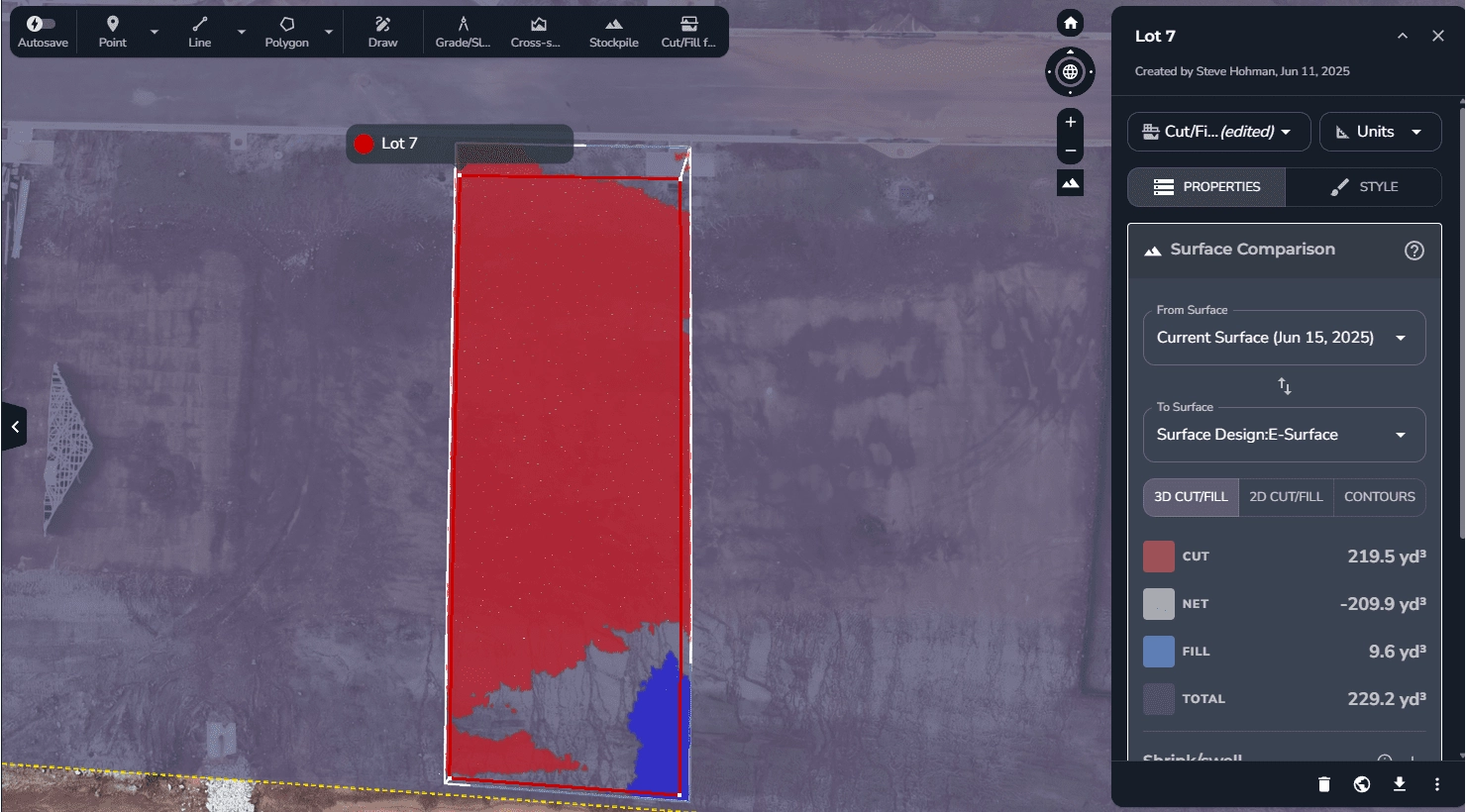
Once land is graded and roads are in, the complexity shifts to individual parcel construction, where coordination, accuracy, and documentation are everything. Our solution delivers precise, up-to-date data for every lot in your subdivision, enabling smoother builds, faster closings, and fewer surprises.
Schedule a demo to see how our platform compares to the competition. We can fly our drone at your location, upload your designs, and show you what our platform can do for you in less than 24 hours. In one demo, we identified a $18,000 error within the first 5 minutes – what will we find on your project site?